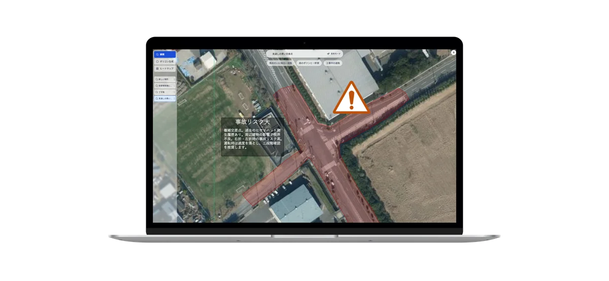
CASE 01
Detecting Near-Miss Hotspots That May Endanger Drivers
Leveraging satellite imagery and geospatial data, AI analyzes road geometry, surrounding structures, and limited visibility to highlight intersections or segments where near-miss incidents likely occurred in the past or may emerge in the future. The resulting map supports prioritizing infrastructure improvements and issuing timely driver alerts.